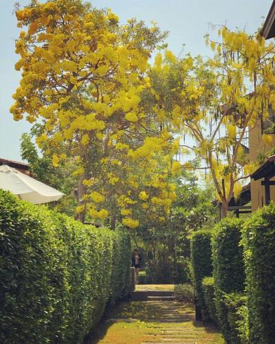
Attraction อุทยานแห่งชาติหมู่เกาะสุรินทร์ Mu Ko Surin National Park : พังงา
เป็นหมู่เกาะในทะเลอันดามันห่างจากฝั่งไปทางทิศตะวันตกประมาณ 70 กิโลเมตร เป็นหมู่เกาะที่อยู่ติดกับเขตชายแดนไทย-พม่า มีพื้นที่ประมาณ 84,375 ไร่ แบ่งเป็นพื้นที่บนบกประมาณ 20,594 ไร่ ประกอบด้วยเกาะสำคัญ 5 เกาะ คือ เกาะสุรินทร์เหนือ เกาะสุรินทร์ใต้ เกาะไข่ (เกาะตอรินลา) เกาะกลาง (เกาะปาจุมบา) และเกาะรี (เกาะสต๊อก)

อุทยานแห่งชาติหมู่เกาะสุรินทร์ Mu Ko Surin National Park
![]()
สำหรับคนชอบสนอร์เกิล หรือการดำน้ำดูปะการังน้ำตื้นแล้ว ทุกคนรู้เลยว่าสักครั้งในชีวิตจะต้องฝ่าคลื่นลมกลางทะเล เพื่อมาสัมผัสโลกใต้ผืนน้ำสีครามที่งดงามของหมู่เกาะสุรินทร์ และด้วยความอุดมสมบูรณ์ของแนวปะการังน้ำตื้น ที่มีมากมายทั้งในเกาะสุรินทร์เหนือและเกาะสุรินทร์ใต้ ที่นี่จึงเป็นแหล่งดำน้ำระดับแถวหน้าของเมืองไทย จะเรียกว่าเป็นอีกหนึ่งสุดยอดทะเลไทยก็คงไม่ผิดนัก มองภาพกว้าง หมู่เกาะสุรินทร์มีสภาพที่กำบังคลื่นลมทั้งสองฤดู เนื่องจากเกาะวางตัวเป็นกลุ่มและมีอ่าวขนาดใหญ่ ทำให้เกิดแนวปะการังริมฝั่งอยู่บริเวณโดยรอบทั้งเกาะสุรินทร์เหนือ เกาะสุรินทร์ใต้ และเกาะบริวาร นอกเหนือจากการรับอิทธิพลจากคลื่นลมแล้ว สภาพแวดล้อมทางสมุทรศาสตร์ของบริเวณหมู่เกาะเหล่านี้เป็นสภาพแวดล้อมที่เหมาะต่อการพัฒนาของแนวปะการัง คือ น้ำใส อุณหภูมิพอเหมาะ มีแสงแดดส่องถึงในปริมาณที่พอดี และมีการผสมผสานของน้ำที่ได้รับสารอาหารจากมวลน้ำเบื้องล่างที่ปะทะเกาะ ความอุดมสมบูรณ์ของแพลงก์ตอนซึ่งเป็นอาหารสำหรับปลาและสัตว์อื่น ๆ ทำให้ทะเลรอบ ๆ หมู่เกาะสุรินทร์นั้นหนาแน่นด้วยแนวปะการังน้ำตื้นที่มีความหลากหลายทางชีวภาพสูงมาก จนได้รับยกย่องว่าเป็นแหล่งกำเนิดของแนวปะการังน้ำตื้นขนาดใหญ่และสมบูรณ์ที่สุดแห่งหนึ่งของประเทศไทย อย่างไรก็ตาม ด้วยปัจจัยทางสมุทรศาสตร์ที่สำคัญอีกประการหนึ่งคือ ลักษณะของน้ำขึ้นน้ำลงในทะเลอันดามัน ซึ่งเป็นแบบ Semidiurnal คือน้ำขึ้นและน้ำลงอย่างละ 2 ครั้ง ใน 24 ชั่วโมง และความแตกต่างระหว่างน้ำขึ้นสูงสุดและต่ำสุดอาจถึง 3 เมตร ทำให้มีกระแสน้ำเลียบฝั่งค่อนข้างแรง สำหรับเกาะสุรินทร์เหนือและเกาะสุรินทร์ใต้นั้น ตั้งอยู่ชิดกันคล้ายเกาะแฝด โดยมีพื้นน้ำตื้น ๆ กว้างประมาณ 200 เมตร กั้นอยู่ โดยเฉพาะในช่วงน้ำลงนั้น สามารถข้ามไปยังอีกเกาะได้เลยทีเดียว จุดนี้เองเป็นจุดที่เรียกกันว่า อ่าวช่องขาด ส่วนเกาะขนาดเล็กอีกสามเกาะเป็นเกาะหินที่มีต้นไม้แคระแกร็นขึ้นอยู่ไม่หนาแน่นนัก พืชพรรณที่พบเป็นพืชป่าดิบชื้น ฤดูกาลเหมาะสม หมู่เกาะสุรินทร์สามารถแบ่งฤดูกาลออกได้เป็น 2 ฤดู ได้แก่ ฤดูร้อน เริ่มตั้งแต่กลางเดือนกุมภาพันธ์ถึงกลางเดือนพฤษภาคม ฤดูฝนเริ่มตั้งแต่กลางเดือนพฤษภาคมถึงเดือนตุลาคม ปริมาณฝนเฉลี่ยในแต่ละปีจะมีค่ามากกว่า 3,000 มิลลิเมตร ความชื้นสัมพัทธ์เฉลี่ยตลอดทั้งปีประมาณ 83 เปอร์เซ็นต์ ในฤดูฝนเป็นช่วงที่ได้รับอิทธิพลของลมมรสุมตะวันตกเฉียงใต้ นอกจากจะทำให้ฝนตกหนักแล้ว ท้องทะเลยังมีคลื่นลมแรง ทำให้การเดินทางไปท่องเที่ยวที่อุทยานแห่งชาติหมู่เกาะสุรินทร์ในช่วงนี้ไม่ปลอดภัยสำหรับนักท่องเที่ยว จึงได้มีการกำหนดปิด-เปิดฤดูท่องเที่ยวประจำปี ดังนี้ ปิดฤดูท่องเที่ยว ตั้งแต่วันที่ 1 พฤษภาคม-31 ตุลาคม ของทุกปี เปิดฤดูท่องเที่ยว ตั้งแต่วันที่ 1 พฤศจิกายน-30 เมษายนของทุกปี - อุทยานฯ มีบ้านพักและสถานที่กางเต็นท์ไว้บริการ
![]()
***ปิดการท่องเที่ยวและพักแรมในอุทยานแห่งชาติ วันที่ 16 พฤษภาคม ถึง 14 ตุลาคม
![]()
![]()
Situated in Tambon Ko Phra Thong and covering an area of 84,375 rais (33,750 acres), Mu Ko surin is an archipelago of 5 islands: Ko Surin Nuea, Ko Surin Tai, Ko Ri, Ko Khai, and Ko Klang. It was declared a national park on July 9, 1981. The archipelago is located in the Andaman sea, near the Thai-Burmese sea border, to the west coast of Thailand.
![]()
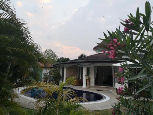
Mu Ko surin national park is an archipelago in the Andaman sea located approximately 70 kilometers off the western shore next to the Thailand-Myanmar border. The Park comprises 5 major islands; namely, Ko Surin Nuea, Ko Surin Tai, Ko Kai (Ko Torinla), Ko Klang (Ko Pachumba), and Ko Ri (Ko Satok). It was proclaimed a National Park on July 9, 1981, and includes islands with beautiful coral reefs in the shallows and various schools of fish of different colors. It offers ideal spots for snorkeling to admire coral reefs in the shallows, especially at Ko Torinla and Ko Pachumba. An ideal spot for scuba diving is the Richeliu Rock, 10 kilometers to the southwest of Ko Surin. This site is a fertile undersea nature habitats various kinds of fish, colorful corals, and where whale shark, the kind Giant of the Sea, is frequently encountered. The most suitable period for a visit is between November and April whereas from May to October is the period of monsoons when there are heavy rainfalls and windy wavy sea. Interesting attractions within the National Park: Ko Surin Nuea and Ko Surin Tai are two attached islands separated by a water channel. There are both large and small bays scattered around the islands, all with distinctively beautiful beaches. Ko Surin Nuea is where the Park's Ranger Station is located with a Tourist Service Centre, bungalows, camping site, and long-tailed boats for rent to visit various islands are all here. Ao Chong Khat is located south of Ko Surin Nuea and has a camping spot on a clean white sandy beach suitable for swimming and snorkeling to see coral reefs with various kinds of colorful fish such as parrotfish and wrasse. Ao Mae Yai is also south of Ko Surin Nuea and offers a bay of calm sea. It is the largest island in the Surin Archipelago with coral reefs in the shallows. Ao Sai En is situated east of Ko Surin Nuea, with boat people known as Chao Le or Mogen People the sea tribes settled their life here. They believe in Indian icons carved wood regarded as their sacred items. During the full moon day's period of April every year, they will gather to pay respect to their revered spirits for 3 days. Ao Luek is to the southeast of Ko Surin Nuea and offers coral reefs in the where it acts as schools of clown fish. Ao Chak is to the north of Ko Surin Nuea and offers a white powdery beach and snorkeling spot to admire coral reefs in the shallows. Ao Mai Ngam is to the west of Ko Surin Nuea next to the headquarters bay. It is a large bay with a long curving beach, beautiful coral reefs. Moreover, there is Ao Mai Ngam Nature Trail through an evergreen forest along the beach, with nature interpretation signs along the 2-kilometres route, taking approximately 1 hour. Along the route, various species of wildlife and flora such as mouse deer, flying lemur, and rare birds like Nicobar pigeon and pied imperial pigeon can be seen. Ao Bon is located east of Ko Surin Tai and inhabited by another group of the Mogen or Chao Le people. Ao Tao is located east of Ko Surin Tai and a habitat of a large number of sea turtles near the coral reefs. It offers a snorkeling spot to view soft corals and sea fans. Ao Phak Kat is to the south of Ko Surin Tai and offers a snorkeling spot to view staghorn coral reefs. It's also a good spot to do scuba diving. Ao Suthep is to the north of Ko Surin Tai offers a beautiful coral reefs to snorkle. Ko Pachumba or Ko Klang situates on the north of Ko Surin Tai. It offers clean white powdery beaches and intact coral reefs where Manta rays and other rare fishes including giant lobsters. The bay is called Ao Mang Kohn after the Thai name of lobster, Kung Mang Kohn (Dragon prawn). It is also a spawning site for sea turtles as well. Ko Kai or Ko Torinla is south of Ko Surin Tai. To the east of the island, there is a very long stretch of coral reefs that are still in perfect condition and ideal for scuba diving. Accommodation: The Park provides 16 bungalow rooms for 2 persons. A tent for rent is also available.
![]()
Get Around: There are two boat trips a day to go around the island in the morning and afternoon. Opening hours: 9am-5pm
![]()
Contact: Mu Ko Surin National Park, Tambon Khura. Amphoe Khura Buri, Phang-nga 82150 Tel. 076-491-378, 076-491-582, 02-562-0760
![]()
How Getting there: To Khura Buri district:
![]()
By car, from Amphoe Mueang Phang-nga, take Highway No. 4 (Phetchakasem Road) toward Khura Buri district (Amphoe) and turn left at Km. 721, 6 kilometers before reaching Amphoe Khura Buri, for 3 kilometers. The Park's direction sign will be seen on the right. By bus, the Transport Company Limited operates air-conditioned buses from the Bangkok Southern Bus Terminal on Borommaratchachonnani Road once a day, leaving Bangkok at 8.00 p.m. and arriving in Amphoe Khura Buri at 8.00 a.m., taking a total of 12 hours.
![]()
For further information, please call the BangKohk Office, Tel. 02-894-6122, Amphoe Khura Buri Office, Tel. 076-491-218.
![]()
Ferry and Charter Boat Khura Buri Pier is the nearest point to Mu Ko Surin. Khura Buri is some 125 kilometers north of Phang-nga. A boat trip takes around 3 hours. There is no regular boat service for travelers to Ko Surin. Boats leaving from Khura Buri are suitable for group tours. Contact Mu Ko Surin National Park at Tel. 076-491-378. Thap Lamu Pier in Amphoe Thai Mueang offers 4-hour-journey of ferryboat. Visitors may contact any travel agency nearby.
![]()
![]()
Latitude : 9.434551621452934, Longitude : 97.8678269437805
View Larger Map

View On Google Map
Edit Data
Images
-
อุทยานแห่งชาติหมู่เกาะสุรินทร์ Mu Ko Surin National Park
-

อุทยานแห่งชาติหมู่เกาะสุรินทร์ Mu Ko Surin National Park
-

อุทยานแห่งชาติหมู่เกาะสุรินทร์ Mu Ko Surin National Park
-

อุทยานแห่งชาติหมู่เกาะสุรินทร์ Mu Ko Surin National Park
-

อุทยานแห่งชาติหมู่เกาะสุรินทร์ Mu Ko Surin National Park
-

อุทยานแห่งชาติหมู่เกาะสุรินทร์ Mu Ko Surin National Park