Attraction อุทยานแห่งชาติตาพระยา Ta Phraya National Park : สระแก้ว

อุทยานแห่งชาติตาพระยา Ta Phraya National Park
![]()
ข้อมูลทั่วไป อุทยานแห่งชาติตาพระยาเป็นส่วนหนึ่งในเทือกเขาพนมดงรัก ตั้งอยู่ในแนวทิศตะวันออกยาวไปทางทิศตะวันตก บริเวณทิศใต้ของที่ราบสูงโคราช มีเนื้อที่ทั้งสิ้นประมาณ 371,250 ไร่ หรือ 594 ตารางกิโลเมตร โดยครอบคลุมเนื้อที่ 2 จังหวัด ได้แก่ สระแก้ว และบุรีรัมย์ อยู่ห่างจากกรุงเทพมหานครไปทางทิศตะวันออก ประมาณ 380 กิโลเมตร มีอาณาเขตติดต่อกับประเทศกัมพูชา
![]()
ความเป็นมา : เนื่องด้วยกรมป่าไม้ได้รับแจ้งจากกองทัพภาคที่ 1 ขอให้พิจารณาประกาศจัดตั้งป่าบริเวณเทือกเขาบรรทัด รอยต่อ 3 จังหวัด คือ จังหวัดปราจีนบุรี จังหวัดนครราชสีมาและจังหวัดบุรีรัมย์ ซึ่งมีสภาพป่าอุดมสมบูรณ์เป็นป่าเบญจพรรณ ป่าดิบแล้ง และป่าเต็งรัง ให้เป็นอุทยานแห่งชาติ กรมป่าไม้ได้พิจารณาแล้วจึงให้นายอภิศักดิ์ จัตตุพรพงษ์ นักวิชาการป่าไม้ 5 ปฎิบัติงานประจำอุทยานแห่งชาติเขาใหญ่ ในขณะนั้น ไปดำเนินการสำรวจ และจัดตั้งพื้นที่ป่าสงวนแห่งชาติ ป่าตาพระยา ป่าดงใหญ่ ป่าบ้านกรวด แปลงที่ห้า และป่าใกล้เคียง ในท้องที่จังหวัดสระแก้ว และจังหวัดบุรีรัมย์ เป็นอุทยานแห่งชาติ ตามคำสั่งกรมป่าไม้ ที่ 1640/2534 ลงวันที่ 2 กันยายน 2534 เนื่องจากพื้นที่แห่งนี้เป็นจุดยุทธศาสตร์ที่สำคัญแห่งหนึ่งในอดีต (ปี พ.ศ. 2515 - พ.ศ.2531) เคยอยู่ภายใต้อิทธิพลของพรรคคอมมิวนิสต์แห่งประเทศไทย มีการต่อสู้ระหว่างเจ้าหน้าที่ของรัฐกับผู้ก่อการร้ายคอมมิวนิสต์แห่งประเทศไทยอย่างรุนแรง เกิดความเสียหายทั้งชีวิตและทรัพย์สินอย่างมากจนกระทั่งปี พ.ศ. 2525 ใช้การเมืองนำการทหารจนกองกำลังติดอาวุธของพรรคคอมมิวนิสต์แห่งประเทศไทยยอมเข้ามอบตัว แปรสภาพฐานะเป็นผู้ร่วมพัฒนาชาติไทยในที่สุดความสงบสุขในพื้นที่แห่งนี้จึงกลับมาเยือนอีกครั้ง อุทยานแห่งชาติตาพระยาได้ประกาศให้เป็นอุทยานแห่งชาติโดยได้มีพระราชกฤษฏีกากำหนดบริเวณที่ดินป่าบ้านกรวด แปลงที่ห้า และป่าดงใหญ่ ในท้องที่ตำบลบึงเจริญ ตำบลจันทบเพชร ตำบลสายตะกู ตำบลหนองไม้งาม ตำบลปราสาท อำเภอบ้านกรวด ตำบลโนนดินแดง ตำบลลำนางรอง กิ่งอำเภอโนนดินแดง อำเภอละหานทราย ตำบลสำโรงใหม่ ตำบลหนองแวง ตำบลตาจง อำเภอละหานทราย จังหวัดบุรีรัมย์ และป่าตาพระยา ในท้องที่ตำบลทัพราช ตำบลทัพไทย อำเภอตาพระยา จังหวัดสระแก้ว ประกาศในราชกิจจานุเบกษา เล่ม 113 ตอนที่ 65 ก ลงวันที่ 22 พฤศจิกายน 2539 เป็นอุทยานแห่งชาติ ลำดับที่ 82 ลักษณะภูมิประเทศ อุทยานแห่งชาติตาพระยา เป็นเทือกเขาสูงจากเทือกเขาบรรทัดตลอดแนวจนไปถึงเทือกเขาพนมดงรัก เป็นแนวเขตติดต่อระหว่างไทยกับสาธารณรัฐกัมพูชาประชาธิปไตย ตั้งแต่หลักเขตประเทศที่ 24 ถึง หลักเขตที่ 28 วางตั้งในแนวทิศตะวันตกไปทิศตะวันออก สูงจากระดับน้ำทะเลประมาณ 206-579 เมตร ยอดเขาที่สูงที่สุดคือ ยอดเขาพรานนุช ความสูง 579 เมตรจากระดับน้ำทะเล มีความลาดชันเฉลี่ยทั้งพื้นที่ประมาณ 35 เปอร์เซ็นต์ บริเวณที่ตั้งอยู่ทางทิศตะวันออกเฉียงใต้ของที่ราบสูงโคราช ซึ่งมีความสูงเฉลี่ยประมาณ 100-200 เมตร จากระดับน้ำทะเล ประกอบด้วยเขาเขาวง เขาสะแกกรอง เขาบรรทัด เขาเนินหิน เขาพนมแม่ไก่ เป็นต้นน้ำลำธารของลำสะโดน ห้วยซับกระโดน ลำนางรอง ลำจันหัน ห้วยตรุมะเมียง ห้วยแห้ง ห้วยละหอกพลวง ห้วยดินทราย ห้วยนาเหนือ ห้วยพลู และห้วยเมฆา
![]()
ลักษณะภูมิอากาศ สภาพภูมิอากาศโดยทั่วไปของภูมิภาคนี้มักอยู่ภายใต้อิทธิพลของลมมรสุมตะวันออกเฉียงใต้ลมมรสุมตะวันออกเฉียงเหนือ ในช่วงฤดูลมมรสุมตะวันตกเฉียงใต้ ตั้งแต่กลางเดือนพฤษภาคม-เดือนตุลาคม ความชุ่มชื้นจะถูกพัดพามาจากทะเลอันดามันและอ่าวไทย จนทำให้พื้นที่บริเวณนี้ได้รับปริมาณน้ำฝนเฉลี่ยต่อเดือนวัดได้ระหว่าง 100 มิลลิเมตร ถึง 140 มิลลิเมตร ในฤดูลมมรสุมตะวันตกเฉียงใต้ เทือกเขาพนมดงรักจะปะทะกับลมมรสุม และทำให้ฝนตกในบริเวณด้านที่รับลมมากกว่าด้านไม่รับลม ฤดูกาลมี 3 ฤดู ได้แก่ ฤดูร้อน เริ่มตั้งแต่เดือนกุมภาพันธ์ถึงเดือนเมษายน ฤดูฝนตั้งแต่เดือนพฤษภาคมถึงเดือนตุลาคม และฤดูหนาวตั้งแต่เดือนพฤศจิกายนถึงเดือนมกราคม สำหรับอุณหภูมิเฉลี่ยตลอดทั้งปีสูงสุดประมาณ 39.8 องศาเซลเซียส อุณหภูมิต่ำสุดประมาณ 14.3 องศาเซลเซียส
![]()
พืชพรรณและสัตว์ป่า ในภูมิภาคแถบนี้ยังมีสภาพป่าที่สมบูรณ์กระจายอยู่ในพื้นที่โดยทั่วไปเป็นป่าเบญจพรรณ ป่าดิบแล้ง และป่าเต็งรัง
![]()
1) ป่าเบญจพรรณ ป่าชนิดนี้ขึ้นอยู่ระดับความสูง 400 เมตร จากระดับน้ำทะเล ปรากฏอยู่ทางทิศเหนือและทิศตะวันออกเฉียงเหนือของพื้นที่อุทยานแห่งชาติ คือ ในท้องที่จังหวัดบุรีรัมย์ ไม้ที่สำคัญ คือ มะค่าโมง แดง ตะแบกใหญ่
![]()
2) ป่าดิบแล้ง ป่าชนิดนี้อยู่พื้นที่ค่อนข้างราบ ทางทิศเหนือและทิศตะวันออกเฉียงเหนือของพื้นที่อุทยานแห่งชาติในท้องที่จังหวัดบุรีรัมย์ และบางส่วนของจังหวัดปราจีนบุรี มักจะอยู่ในระดับความสูงประมาณ 100-400 เมตร จากระดับน้ำทะเล ไม้ที่สำคัญ ได้แก่ มะค่าโมง ยางนา พยอม ตะเคียนทอง
![]()
3) ป่าเต็งรัง ป่าชนิดนี้อยู่ในพื้นดินทิศใต้และดินทิศเหนือบางส่วน อยู่กระจายกันในจังหวัดปราจีนบุรี และจังหวัดบุรีรัมย์ ได้แก่ เต็ง รัง และเหียง สัตว์เลี้ยงลูกด้วยนม ที่พบเห็นได้แก่ เลียงผา กวาง เก้ง กระจง หมี หมูป่า ลิง ค่าง ชะนี อีเห็น ชะมด เสือไฟ เสือปลา วัวแดง กระทิง หมาไน แมวป่า หมูหริ่ง บ่าง เม่น พังพอน ค้างคาว กระต่ายป่า กระรอก กระรอกบิน กระแต เป็นต้น นกที่พบเห็นได้แก่ นกพญาไท นกขุนแผน นกแก้ว นกเขาเขียว นกกางเขนดง นกหัวขวาน นกเหยี่ยว นกฮูก นกปรอด นกแขวก นกเค้าแมว นกดุเหว่า ไก่ป่า ไก่ฟ้า นกขุนทอง เป็นต้น สัตว์ครึ่งบกครึ่งน้ำ ที่พบเห็นได้แก่ งูชนิดต่าง ๆ ตะกวด ลิ่น ตุ๊กแก กิ้งก่า จิ้งเหลน แย้ ตะขาบ แมลงป่อง กิ้งกือ ปลาที่พบเห็นได้แก่ ปลาช่อน ปลาดุก ปลากระทิง ปลาหมอ ปลาบู่ ปลาตะเพียน ปลาสลิด ปลาซิว
![]()
![]()
![]()
Ta Phraya National Park General Information Tapraya National Park is close to Pang Sida National Park and is part of Phanom Dong Rak Mountain Range located in the eastern side lying towards the west. It covers 2 provinces, that is, Sa Kaew and Burirum Provinces. The landscape is high mountains from Bantat Mountain range to Phanom Dong Rak Mountain range. It is the connecting point between Thailand and Cambodia. The highest peak is Pran Nuch Peak, which is about 579 m. high Climate The weather in this area is usually influenced by southwestern monsoon and northeastern monsoon. In the period of southwestern monsoon from May to October, there is high humidity wind blowing from Andaman Sea and Gulf of Thailand causing rain in this area about 100 – 140 mm. of rain per year. And there is also Phanom Dongrak Mountain Range against the southwestern monsoon that causes heavy rain in the front and not much rain in the back. The weather consists of three seasons; the summer from February to April; the rains from May to October; and the winter from November to January. Approximately temperature is 39.8 degrees Celsius and the lowest temperature is 14.3 degrees Celsius. Flora and Fauna In this region there are fertile forests, most of which are mixed deciduous, dry evergreen and dipterocarp forest. Wild animals found are, for instances, mountain goat, deer, bear, warthog, monkey, red bull, and bull. Besides, there are various kinds of birds living in the park, such as minivet, blue magpie, parrot, and woodpecker. Historical Rao Soo Monument was built for the people sacrificing themselves to the country. Tourists often visit and worship here. It is located in Noan Din Daeng Subdistrict, Amphur Lahan Sai , Buriram Province. Activities - Historical Sight Seeing San (Shrine) Mee Aksorn is the ground that bears the handwriting of H.M. King Chulalongkorn. Tourists love to drop by to worship. It has very beautiful scenery, located in Tapraraj sub-district, Amphur Tapraya Sa Kaew Province. Activities - View - Historical Sight Seeing Prasart (castle) Khao Loan is an old casle built in the Khom Age, located in Tapraraj subdistrict, Amphur Ta Praya , Sa Kaew Province. Activities - Historical Sight Seeing Chong Obok (Obok Opening) Chong Obok is an opening border for local people between Thailand and Cambodian communicating each other, in Prasart Sub-district, Ban Kruad District, Buri Rum Province. There is productive semi-evergreen forest which causes water in streams all the year round. The area has been believed that it has waterfalls and a great number of wild animals, but not suitable for traveling because there are a lot of land mines. Activities - don't visit Prasart (castle) Bai Bak is an old castle built in the Khom Age, located in Chantakapetch Sub-district. Take the highway 2121 and turn into highway 5 at the intersection. Activities - Historical Sight Seeing Lang Loha Kram There is an area of ancient Cambodian’s culture in Chanta Borphet Sub-district, Baan Kruad District, Buri Rum Province which is interesting for many travelers to sigh-seeing ancient remains. Use national road number 2121 and turn at second road number 7 to get there. Activities - Historical Sight Seeing Prasart (castle) Thong is an old castle built in the Khom Age. Take the highway 2121. Activities - Historical Sight Seeing Refuge Camp Site II Refuge Camp Site II is a shelter for Cambodian refuge located in Thub Thai Village, Thub Sadej Sub-district, Ta Praya District, Prachin Province. Many people are interested in traveling there. Use national road number 3068 and turn at Ta Praya District Junction to the national road of the province. Activities - Historical Sight Seeing The Beautiful of Nature Huai Yang Reservoir Huy Yang is a large reservoir located in Thub Rach Sub-district, Tha Pha Ya District, Prachin Buri Province. There is wonderful scenery especially in the productive semi-evergreen forest around the reservoir. Many people go to recreate in the area all the year round. Travel on national road number 3189 to get there. Activities - Camping - View Lam Namg Rong Reservoir Lam Namg Rong is a large reservoir in Nang Rong Sub-district, Lahan Sai District, Buri Rum Province. There are wonderful scenery of productive forest around the reservoir, and beaches for playing water in Song Kran Day. Many people go to recreate there all the year round. Travel on national road number 3068 to get there. Activities - Camping - View Lam Chung Hun Reservoir Lam Chung Hun is a large reservoir in Sam Rong Mai Sub-district, Lahan Sai District, Buri Rum Province. There is very beautiful scenery of productive semi-evergreen forest. Many people go to recreate there. Travel on national road number 3068 and turn to the national road of the province for 13 kilometer. Activities - View - Nature trail study Lam Pra Tia Reservoir Lam Pra Tia is a medium-size reservoir in Nong Wang Sub-district, Lahan Sai District, Buri Rum Province. There is very beautiful scenery around. Many people go to recreate there all the year round. Travel on national road number 3068 and go further on ARD Road. Activities - View Me Kha Reservoir Me Kha is a large reservoir in Nong Mai Ngam Sub-district, Baan Kruad District, Buri Run Provinc. There is productive semi-evergreen forest which is interested by many people to go to recreate all the year round. Travel there by using national road number 3068. Activities - View Lan Hin Tad (Stone Field) is a beautiful natural creation. It is located Prasart Subdistrict,Amphur Ban Gluad , Burirum province. Take the Highway 2121 and turn intohighway 4 at the intersection. Activities - Cave/Geological Touring Lan Kra Jiew Lan Kra Jiew is a rocky plain which has many beautiful Kra Jiew flowers growing all over the area. The area, has productive forest suitable for traveling, locates in Prasart Sub-district, Baan Kruad District, Buri Rum Province. Traveler can get there by using national road number 2121 and turning to Montri Road. Contact Address Ta Phraya National Park Amphur Ta Phraya Sakaeo Thailand 31260 Tel. 0 4561 9214 E-mail reserve@dnp.go.th How to go? By Car Tapraya National Park by car: Follow the highway 3198 (Aranyaprathet - Tapraya) and road number 2121 (Lahan Sai - Ban Gruad)
![]()
![]()
![]()
![]()
Latitude : 14.129123355939035, Longitude : 102.58190080756518
View Larger Map

View On Google Map
Edit Data
Images
-

อุทยานแห่งชาติตาพระยา Ta Phraya National Park
-
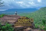
อุทยานแห่งชาติตาพระยา Ta Phraya National Park
-
อุทยานแห่งชาติตาพระยา Ta Phraya National Park
-
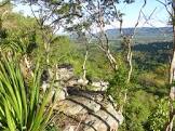
อุทยานแห่งชาติตาพระยา Ta Phraya National Park
-
อุทยานแห่งชาติตาพระยา Ta Phraya National Park
-
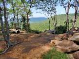
อุทยานแห่งชาติตาพระยา Ta Phraya National Park