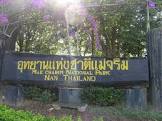
Attraction อุทยานแห่งชาติแม่จริม Mae Charim National Park : น่าน
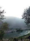
ลักษณะภูมิประเทศ ภูมิประเทศของอุทยานแห่งชาติแม่จริม มีลักษณะเป็นภูเขาสลับซับซ้อนมีความสูงชันมากกว่า 35 เปอร์เซ็นต์ ทอดตัวจากทิศเหนือไปทางทิศตะวันตกเฉียงใต้ มีเทือกเขาหลวงพระบางซึ่งทอดตัวจากทิศเหนือลงสู่ทิศใต้ เป็นเขตแนวเขตกั้นระหว่างประเทศไทยและประเทศลาว อยู่เหนือจากระดับน้ำทะเลตั้งแต่ 300-1,652 เมตร ความสูงของเทือกเขาจะค่อยลดหลั่นไปทางทิศตะวันตก ยอดดอยที่มีความสูงมากที่สุดคือ ดอยขุนลาน (1,652 เมตร) อยู่ทางทิศตะวันออกของพื้นที่ รองลงมาคือ ดอยแดนดิน (1,558 เมตร) ดอยขุนน้ำปูน (1,530 เมตร) ดอยขุนคูณ (1,307 เมตร) มีแม่น้ำว้าซึ่งไหลมาจากเทือกเขาหลวงพระบางไหลผ่านทางทิศตะวันตกของพื้นที่ เป็นระยะทางประมาณ 7.5 กิโลเมตร มีลำธาร และลำห้วยที่เป็นต้นน้ำน่านอยู่หลายสาย เช่น ห้วยทรายมูล ห้วยสาสี่ ห้วยบ่ายน้อย ห้วยบ่ายหลวง ห้วยน้ำพาง ลำน้ำแปง และแต่ละสายล้วนเป็นอู่น้ำของราษฎรรอบพื้นที่

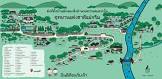
อุทยานแห่งชาติแม่จริม Mae Charim National Park
![]()
พืชพรรณและสัตว์ป่า สภาพป่าอุทยานแห่งชาติแม่จริมประกอบด้วย ป่าดิบชื้น ป่าดิบแล้ง ป่าดิบเขา ป่าสนเขา ป่าเบญจพรรณ และป่าเต็งรัง สัตว์ป่าที่ เด่น ได้แก่ เสือ เลียงผา หมี และนกยูง
![]()
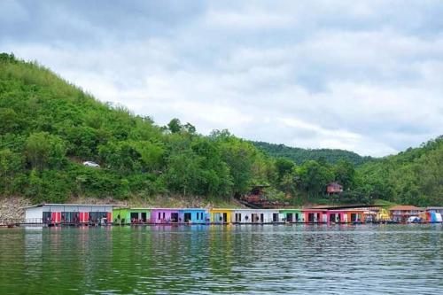
ล่องแก่งลำน้ำว้า เป็นกิจกรรมนันทนาการหลักของอุทยานแห่งชาติแม่จริม จุดเริ่มต้นที่บ้านน้ำปุ๊ ตำบลน้ำพาง อำเภอแม่จริม และสิ้นสุดที่บ้านหาดไร่ ตำบลส้านนาหนองใหม่ อำเภอเวียงสา จังหวัดน่าน ระยะทางจะเหลือ 19.2 กิโลเมตร ตลอดเส้นทางล่องแก่งมีเกาะแก่งให้ผจญภัยตลอดเส้นทาง มีหาดทรายสำหรับจอดแพเล่นน้ำ หลายแห่ง รวมทั้งทัศนียภาพสองฝั่งลำน้ำที่งดงาม โดยเฉพาะในฤดูหนาวจะสวยกว่าฤดูกาลอื่น ๆมาก สามารถล่องแพได้ทุกฤดู ยกเว้นบางช่วงในฤดูฝนซึ่งมีน้ำหลากไม่สมควรล่องแพเพราะอาจเกิดอันตรายได้งาย
![]()
เส้นทางศึกษาธรรมชาติ “ชบาไพร” อุทยานแห่งชาติแม่จริมได้จัดทำเส้นทางศึกษาธรรมชาติ “ชบาไพร” ในบริเวณที่ทำการอุทยานแห่งชาติไว้บริการ เพื่อให้ศึกษาระบบนิเวศป่าไม้ ซึ่งจะได้รับความรู้ต่างๆ ได้จากสถานีที่อยู่ในเส้นทาง
![]()
สถานที่ติดต่ออุทยานแห่งชาติแม่จริม อ. แม่จริม จ. น่าน 55170 โทรศัพท์ 0 5477 9402
![]()
การเดินทาง รถยนต์ จากอำเภอแม่จริมใช้ทางหลวงจังหวัดหมายเลข 1243 สายแม่จริม-น้ำมวบ ไปประมาณ 13 กิโลเมตร ถึงบ้านห้วยทรายมูล มีทางแยกเข้าไปอีก 4 กิโลเมตร ถึงที่ทำการอุทยานแห่งชาติ
![]()
![]()
General Information Since the areas of Nam-wa Forest and Mae Charim Forest, the southeastern part of Nam-Nan Forest, and Huai Sali Forest situated in Tambon Nam-pang, Tambon Nam-pai of Mae Charim District, and Tambon Lai-nan, Tambon Sanna Nhong-mai, Tambon Nam-muab of Viangsa District, Nan Province, consist of valuable natural resources including plants, wild fruits and wild animals, as well as beautiful scenery of forests, mountains, streams, and cliffs, it is deemed expedient to establish Mae Charim Forest as a national park under the National Park Act 1961 for the purpose of conservation within an approximate area of 432 square kilometers or 270,000 rai. The geographical features of the National Park consist of high mountains, extending from the north to the southwest, and Luang Phra-bang Mountains extending from the north to the south (and being used as the boundary between Thailand and Laos). The height of mountains lowers to the west. Doi Khun-lan, situated in the east of the National Park, is the highest mountaintop (1,652 meters above the medium sea level) where Wa River flows from Luang Phra-bang Mountains passing the west of the area for approximately 7.5 kilometers. Rafting on the Wa River Rafting is major recreational activity of the National Park. The route for rafting starts at Ban Nam-pu, Tambol Nam-phong of Mae Charim and finishes at Ban Had-rai, Tambol Sanna Nhong-maiof Viangsa District, Nan Province, totally 19.2 kilometers. In addition, there are islets and reefs along the rafting route for your adventurous experiences. Many spots are provided for tying up the rafts on the riverbank while you are swimming. And the scenery on both sides of the River is very beautiful, particularly in winter. You may enjoy rafting activities in all seasons except in the rainy season due to floodwaters.
![]()
![]()
General Information Since the areas of Nam-wa Forest and Mae Charim Forest, the southeastern part of Nam-Nan Forest, and Huai Sali Forest situated in Tambon Nam-pang, Tambon Nam-pai of Mae Charim District, and Tambon Lai-nan, Tambon Sanna Nhong-mai, Tambon Nam-muab of Viangsa District, Nan Province, consist of valuable natural resources including plants, wild fruits and wild animals, as well as beautiful scenery of forests, mountains, streams, and cliffs, it is deemed expedient to establish Mae Charim Forest as a national park under the National Park Act 1961 for the purpose of conservation within an approximate area of 432 square kilometers or 270,000 rai.
![]()
![]()
The geographical features of the National Park consist of high mountains, extending from the north to the southwest, and Luang Phra-bang Mountains extending from the north to the south (and being used as the boundary between Thailand and Laos). The height of mountains lowers to the west. Doi Khun-lan, situated in the east of the National Park, is the highest mountaintop (1,652 meters above the medium sea level) where Wa River flows from Luang Phra-bang Mountains passing the west of the area for approximately 7.5 kilometers.
![]()
![]()
Rafting on the Wa River Rafting is major recreational activity of the National Park. The route for rafting starts at Ban Nam-pu, Tambol Nam-phong of Mae Charim and finishes at Ban Had-rai, Tambol Sanna Nhong-maiof Viangsa District, Nan Province, totally 19.2 kilometers. In addition, there are islets and reefs along the rafting route for your adventurous experiences. Many spots are provided for tying up the rafts on the riverbank while you are swimming. And the scenery on both sides of the River is very beautiful, particularly in winter. You may enjoy rafting activities in all seasons except in the rainy season due to floodwaters.
![]()
![]()
![]()
Latitude : 18.601625994369357, Longitude : 100.98023949842477
View Larger Map

View On Google Map
Edit Data
Images
-
อุทยานแห่งชาติแม่จริม Mae Charim National Park
-

อุทยานแห่งชาติแม่จริม Mae Charim National Park
-
อุทยานแห่งชาติแม่จริม Mae Charim National Park
-
อุทยานแห่งชาติแม่จริม Mae Charim National Park
-

อุทยานแห่งชาติแม่จริม Mae Charim National Park
-
อุทยานแห่งชาติแม่จริม Mae Charim National Park