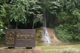
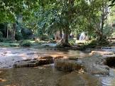
Attraction อุทยานแห่งชาติดอยภูนาง Doi Phu Nang National Park : พะเยา
ลักษณะภูมิประเทศ สภาพทั่วไปเป็นเทือกเขาสลับซับซ้อนสูง ทอดตัวในแนวเหนือใต้ ส่วนป่าแม่ยมและป่าน้ำปี้จะเป็นเทือกเขาสูงทอดตัวกันคล้ายรูปเกือกม้า โดยมีพื้นที่ราบลุ่มของอำเภอเชียงม่วนอยู่ตอนกลางมีจุดสูงสุดของพื้นที่ทั้งสอง คือดอยภูนาง สูง 1,202 เมตร ทำให้เกิดเป็นต้นน้ำที่สำคัญ ซึ่งจะไหลลงแม่น้ำแม่ยมทั้งหมดสูงจากระดับน้ำทะเล 300 เมตร

อุทยานแห่งชาติดอยภูนาง Doi Phu Nang National Park
![]()
![]()
ลักษณะภูมิอากาศ อุณหภูมิเฉลี่ยสูงสุด 31 องศาเซลเซียส อุณหภูมิต่ำสุด 20 องศาเซลเซียส และอุณหภูมิเฉลี่ยตลอดปี 26 องศาเซลเซียส ปริมาณน้ำฝนเฉลี่ยในรอบ 10 ปี ของทั้งสามอำเภอเท่ากับ 1,093-1,778 มิลลิเมตร
![]()
![]()
พืชพรรณและสัตว์ป่า สภาพป่าทั่วไปเป็นป่าดิบชื้น ป่าเบญจพรรณ และป่าเต็งรัง ประกอบด้วยพันธุ์ไม้ที่สำคัญและมีคุณค่าทางเศรษฐกิจ คือ ยาง ตะเคียน ประดู่ มะค่าโมง ตะแบก มะม่วงป่า มะยมป่า จำปาป่า เลียงมัน ตะคร้อ ตีนนก รวมถึงไม้จำพวกก่อและไม้สนเขาขึ้นปะปนอยู่
![]()
![]()
สำหรับสัตว์ป่าที่พบโดยทั่วไปได้แก่ เสือปลา หมีควาย หมูป่า เก้ง อีเห็น อ้น กระแต กระรอก นกชนิดต่าง ๆ รวมถึงสัตว์เลื้อยคลาน
![]()
![]()
ฝั่งต้า ตั้งอยู่ในเขตติดต่อกับบ้านไชยสถาน หมู่ที่ 4 ตำบลเชียงม่วน จังหวัดพะเยา มีสภาพคล้าย แพะเมืองผี คือ เป็นลักษณะของการกัดเซาะพังทะลายของดินที่ภูเขาเตี้ยๆ แห่งหนึ่ง ทำให้เกิดรูปร่างที่คงเหลืออยู่ภายหลังจากการพังทลายอย่างรุนแรงผ่านไปแล้ว มีรูปร่างคล้ายเสาแหลมๆ เรียงรายติดต่อกันเป็นแนวยาวประมาณ 200 เมตร สูงประมาณ 25 เมตร พื้นที่อยู่บริเวณรอยต่อของป่าน้ำปี้และป่าแม่ยมฝั่งซ้าย-น้ำควรฝั่งซ้าย สภาพพื้นที่เป็นภูเขามีทางลูกรังเชื่อมต่อกับบ้านไชยสถานได้ พื้นที่รอบๆ นอกจากจะมีเขตติดต่อกับที่ทำกินของราษฎรบ้านไชยสถานบนยอดเขาของฝั่งต้า ยังเป็นจุดชมทิวทัศน์และบริเวณพักผ่อนได้ เนื่องจากมีพื้นที่ค่อนข้างราบ มีเนื้อที่ประมาณ 3 ไร่ และสามารถมองเห็นความสวยงามได้รอบด้าน
![]()
![]()
น้ำตกธารสวรรค์ น้ำตกธารสวรรค์หรือน้ำตกบ่อเบี้ย ตั้งอยู่ในเขตติดต่อกับบ้านบ่อเบี้ยหมู่ที่ 6 ตำบลบ้านยาง อำเภอเชียงม่วน จังหวัดพะเยา อยู่ในเขตป่าแม่ยมฝั่งขวามีลักษณะเป็นน้ำตกหิน 4 ชั้น ชั้นที่ 1 เป็นที่มีความสูงมากที่สุด ประมาณ 8 เมตร ชั้นที่ 2 สูงประมาณ 2.50 เมตร ชั้นที่ 3 และ 4 สูงประมาณ 2 เมตร มีต้นกำเนิดจากห้วยแม่ปิง ซึ่งประกอบด้วยลำห้วยหลายสายไหลมารวมกัน น้ำตกชั้นที่สวยที่สุดคือ ชั้นที่ 1 ซึ่งตกลงมาจากแผ่นหินปูนที่กว้างประมาณ 150 เมตร สภาพโดยรอบ ๆ จะเป็นป่าเบญจพรรณผสมป่าดิบชื้น และพื้นที่ทำเลของราษฎรบ่อเบี้ย
![]()
![]()
น้ำตกนาบัว ตั้งอยู่ในเขตติดต่อกับบ้านบัว หมู่ที่ 4 ตำบลสระ อำเภอเชียงม่วน จังหวัดพะเยา ซึ่งอยู่ในเขตป่าแม่ยมฝั่งขวาเป็นน้ำตกหินปูนสามชั้น ชั้นที่ 1 มีความสูงประมาณ 10 เมตร กว้างประมาณ 6 เมตร ชั้นที่ 2 อยู่ห่างจากชั้นที่ 1 ไปทางทิศตะวันออกเฉียงเหนือประมาณ 5 กิโลเมตร สูงประมาณ 6 เมตร กว้างประมาณ 15 เมตร ชั้นที่ 3 อยู่ห่างจากชั้นที่ 2 ไปทางทิศเหนือประมาณ 500 เมตร กว้างประมาณ 20 เมตร มีต้นกำเนิดมาจากห้วยแม่จั๊งซึ่งมีน้ำไหลตลอด
![]()
![]()
เส้นทางศึกษาธรรมชาติ เส้นทางเดินเท้านี้จะพาไปสู่ธรรมชาติอันสวยงามของอุทยานแห่งชาติดอยภูนาง ซึ่งทางอุทยานแห่งชาติได้จัดไว้ในบริเวณที่ทำการอุทยานแห่งชาติ น้ำตกห้วยต้นผึ้ง และห้วยยั๊วะ
![]()
น้ำตกห้วยต้นผึ้ง เป็นน้ำตกขนาดเล็กมี 3 ชั้น ชั้นที่ 3 สูงประมาณ 40 เมตร และมีน้ำไหลตลอดปี การเดินทางใช้ทางหลวงจังหวัดหมายเลข 1251 สายดอกคำใต้-เชียงม่วน เมื่อผ่านสามแยกบ้านบ่อเบี้ยไปประมาณ 1 กิโลเมตร จะพบกับทางเข้าน้ำตกซึ่งเป็นทางเดินเท้าประมาณ 1 กิโลเมตร ตลอดเส้นทางจะพบกับธารน้ำตกชั้นเล็กชั้นน้อย
![]()
ถ้ำใหญ่ผาตั้ง เป็นถ้ำลึกประมาณ 800 เมตร มีหินงอกหินย้อยงดงามอยู่ทั่วไป บริเวณผาตั้งยังมีถ้ำขนาดเล็กอีกหลายแห่ง มีหน่วยพิทักษ์อุทยานแห่งชาติที่ ภน.1 (ถ้ำผาตั้ง) คอยดูแลและอำนวยความสะดวก ถ้ำใหญ่ผาตั้งอยู่ห่างจากอำเภอปงไปประมาณ 23 กิโลเมตร และอยู่ห่างจากบ้านผาตั้งไปอีก 1 กิโลเมตร
![]()
![]()
สถานที่ติดต่อ อุทยานแห่งชาติดอยภูนาง หมู่ 6 ต.บ้านมาง อ. เชียงม่วน จ. พะเยา 56160 โทรศัพท์ 0 5448 9202
![]()
![]()
การเดินทาง รถยนต์
![]()
• ทางหลวงจังหวัดหมายเลข 1091 สายอำเภอจุน-จังหวัดน่าน ซึ่งอยู่ด้านทิศเหนือติดต่อมาทางด้านทิศตะวันออกของป่าแม่ยมฝั่งขวา และตัดผ่านป่าปี้ไปยังอำเภอบ้านหลวงจังหวัดน่าน เป็นเส้นทางที่สะดวกสามารถใช้ได้ทุกฤดูกาล
![]()
• ทางหลวงจังหวัดหมายเลข 1120 สายอำเภอเชียงม่วน-อำเภอสอง ซึ่งอยู่ต่อจากทางหลวงจังหวัด หมายเลข 1091 ไปทางตอนใต้ ตัดผ่านป่าปี้ ไปยังอำเภอสอง จังหวัดแพร่ เป็นอีกเส้นทางหนึ่งที่ใช้ได้ตลอดฤดูกาล
![]()
• ทางหลวงจังหวัดหมายเลข 1251 สายอำเภอดอกคำใต้-อำเภอเชียงม่วน ตัดผ่านป่าแม่ยมฝั่งขวา จากเขตตำบลหนองหล่ม อำเภอดอกคำใต้ จังหวัดพะเยา ไปเชื่อมกับทางหลวงจังหวัดหมายเลข 1091 สายอำเภอจุน จังหวัดน่าน ที่บริเวณบ้านสระ ตำบลสระ อำเภอเชียงม่วน จังหวัดพะเยา มีระยะทางไปเขตป่าแม่ยม ขวางประมาณ 3.5 กิโลเมตร และเข้าไปบ้านนาบัว หมู่ 4 ตำบลสระ อำเภอเชียงม่วน ประมาณ 10 กิโลเมตร (บ้านนาบัวและบ้านห้วยก้างปลาอยู่ในเขตการปกครองหน่วยเดียวกันแต่มีชื่อเรียกตามท้องถิ่นต่างกันไป)
![]()
สถานที่กางเต็นท์/เต็นท์ อุทยานแห่งชาติ ยังไม่ที่พัก-บริการไว้บริการนักท่องเที่ยว หากสนใจที่จะเดินทางไปท่องเที่ยวที่อุทยานแห่งชาติ ท่านสามารถนำเต็นท์และอาหารไปเอง หรือติดต่อขอใช้บริการเต็นท์ของอุทยานแห่งชาติ รายละเอียดเกี่ยวกับที่พักเต็นท์ขอให้ติดต่อสอบถามกับอุทยานแห่งชาติโดยตรง
![]()
![]()
General Information Doi Phu Nang National Park is situated in an approximate area of 512 square kilometers or 320,000 rai, covering the areas of Dok Kamtai District, Pong District, and Chiang-muan District of Phayao Province. There are different kinds of forests within the area of the National Park, including dense forests, mixed forests, and timber forests. The National Park also has beautiful natural sightseeing spots including Na-pang Waterfall, Thansawan Waterfall, which are abundant sources of rivers and gullies.
![]()
![]()
The geographical features of the National Park consist of high mountains, extending northwards. Meanwhile, Mae-yom Forest and Nampi Forest consist of high mountains extending like a horseshoe, as well as a low-lying land of Chiang-muan District situated in the middle of the two forests. Doi Phu Nang is the highest mountaintop of the two forests at the altitude of 1,202 meters (or 300 meters above the sea level) and being the source of major gullies flowing into Mae-yom River.
![]()
![]()
Climate The average highest temperature at the National Park is 31.3?C; meanwhile, the lowest temperature is 20.2?C; and the average year-round temperature is 22.5?C. The average rainfalls within 10 years of Dok Kamtai District, Pong District, and Chiang-muan District, are 1,095 mm, 1,777.5 mm, and 1,093.2 mm respectively.
![]()
![]()
Flora and Fauna There are various kinds of forests within the areas of the National Park, including tropical evergreen forests, mixed deciduous forests, and timber forests. Major plants, which are of great economic value, include rubber trees, Malabar ironwood, Leguminosae (Pradoo), Afzelia xylocarpa Roxb., Lagerstroemia (Tabaek), Mangifera caloneura Kurz (wild mango), Ailanthus triphysa (Dennst.) Alston (Mayompa) Michelia alba, Berrya ammonilla Roxb. (Liang Mun), Schleichera oleosa (Takraw), Vitex pinnata Linn. (Teen Nok), Lithocarpus Cantleyanus (Kor), and pine wood.
![]()
![]()
Wild animals found in the National Park include fishing cats, Asiatic black bears, wild boars, Muntiacus Muntjak, masked palm civets, bamboo rats, tree shrews, squirrels, different kinds of birds, and reptiles.
![]()
![]()
Phang-ta Phang-ta is situated within the joint between Nampi Forest and Mae-yom/ Nam-kuan Forest next to Baan Chaiyasathan Moo 4, Tambon Chiang-muan, Phayao Province. Phang-ta looks like Pae-muang-pi of Prae Province, originating from soil erosion at the site of a low mountain, leaving some 25-meter-high pointed soil-pillars connecting for an approximate distance of 200 meters. The geographical condition of Phang-ta consists of mountains and a laterite road connecting to Baan Chaiyasathan. Meanwhile, the surrounding areas of Phang-ta (approximately 3 rai) connecting to agricultural lands of Baan Chaiyasathan villagers on the mountaintop of Phang-ta, can be developed as sightseeing spots and recreational sites due to their flatness and beautiful scenery.
![]()
![]()
Thansawan Waterfall Thansawan Waterfall or Bor-bia Waterfall is a 4-step rocky waterfall situated in the area of Mae-yom Forest next to Ban Bor-bia, Moo 6, Tambol Ban Yang, Chiang-muan District, Phayao Province. Step 1 of the Waterfall is about 8 meters high and being regarded as the most beautiful and the highest step of the Waterfall, falling from a 150-meter-wide limestone plate; meanwhile, Step 2 is about 2.50 meters high, and Step 3 and Step 4 of the Waterfall are about 2 meters high.
![]()
![]()
The Waterfall originated from the multi-branches Mae-ping Gully. The surrounding areas of the Waterfall consist of mixed forests and tropical evergreen forests, as well as the agricultural lands of Bor-bia villagers.
![]()
![]()
Na-bua Waterfall Na-bua Waterfall is a 3-step limestone waterfall with the flowing water throughout the year, situated on the right-hand side of Mae-yom Forest next to Ban-bua, Moo 4, Tambol Sra, Chiang-muan District, Phayao Province. The Waterfall originated from Mae-jung Gully. Step 1 of the Waterfall is about 10 meters high and 6 meters wide; meanwhile, Step 2 is about 6 meters high and 15 meters wide, located in the northeast of Step 1 (approximately 5 km away); and Step 3 is about 20 meters wide, located in the north of Step 2 (approximately 500 meters away).
![]()
![]()
Natural Trail The route for natural study, leading you to the beautiful scenery of Doi Phu Nang National Park, is about 2.105 km long and taking you approximately 3 hours by walking to the National Park.
![]()
![]()
Contact Address Doi Phu Nang National Park Mu 6, Ban Mang Sub-district, Amphur Chiang Muan Phayao Thailand 56160Tel. 0 5448 9202
![]()
![]()
How to go? By Car You may take Highway No.1091 (Joon District – Nan Province), situated in the north extending to the east of Mae-yom Forest and passing Nampi Forest to Ban Luang District of Nan Province, is a convenient route and can be used in all seasons. You may take Highway No.1120 (Chiang Muan District – Song District), connecting Highway No.1091 to the south and passing Nampi Forest to Song District of Nan Province, is another route, which can be used in all seasons. You may take Highway No.1251 (Dokkamtai District – Chiang Muan District), passing the right-hand side of Mae-yom Forest from Tambol Nhong-lom of Dokkamtai District, Phayao Province connecting to Highway No.1091 (Joon District – Nan Province) at Ban Sra of Tambol Sra, Chiang-muan District, Phayao Province, approximately 3.5 km to Mae-yom Forest, and passing Ban Na-bua, Moo 4 Tambol Sra of Chiang-muan District for approximately 10 km (Ban Na-bua and Ban Huai-kangpla are located in the same administrative district but having been called in different local names).
![]()
![]()
Latitude : 18.86125753349514, Longitude : 100.16837004024181
View Larger Map

View On Google Map
Edit Data
Images
-
อุทยานแห่งชาติดอยภูนาง Doi Phu Nang National Park
-
อุทยานแห่งชาติดอยภูนาง Doi Phu Nang National Park
-
อุทยานแห่งชาติดอยภูนาง Doi Phu Nang National Park
-

อุทยานแห่งชาติดอยภูนาง Doi Phu Nang National Park
-

อุทยานแห่งชาติดอยภูนาง Doi Phu Nang National Park
-

อุทยานแห่งชาติดอยภูนาง Doi Phu Nang National Park