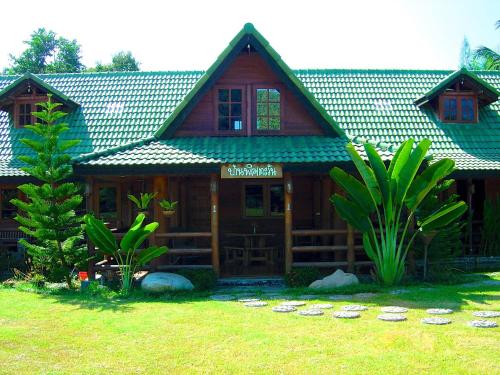
Attraction วัดภูพานอุดมธรรม (ดานสาวคอยวนาราม) Wat Pupan Udomtham : นครพนม
ดานสาวคอย ตั้งอยู่บริเวณวัดภูพานดานสาวคอยวนาราม บนเทือกเขาภูพาน ห่างจากอำเภอนาแกประมาณ 6 กิโลเมตร (เข้าทางเดียวกับมหาวิทยาลัยรามคำแหง นครพนม)

วัดภูพานอุดมธรรม (ดานสาวคอยวนาราม) Wat Pupan Udomtham
![]()
การเดินทาง ขึ้นไปควรใช้รถขับเคลื่อนสี่ล้อ เพราะทางขึ้นขรุขระเป็นหลุมเป็นบ่อ พื้นที่ส่วนใหญ่ของดานสาวคอยเป็นลานหินเรียบ มีต้นไม้เบญจพรรณขึ้นประปราย เมื่อขึ้นถึงลานหินนี้แล้วสามารถมองเห็นยอดพระธาตุพนม ความเป็นมาของสถานที่แห่งนี้เนื่องมาจากหนุ่มสาวชาวบ้านสมัยก่อนเวลาจะไปหาของป่าจะนัดหมายมาคอยกันที่ลานหินนี้เป็นประจำ หรือมาเที่ยวชมความงามโดยฝ่ายสาวจะมาเป็นผู้คอย จึงได้ชื่อว่า “ดานสาวคอย”
![]()
![]()
Wat Phu Phan Udom Tham (Dan Sao Khoi)
![]()
It is located on the Phu Phan Noi mountain range. This place in the old days when young villagers would go to the forest to find things, they used it as a meeting point, or come to see the beauty all the time; so, it is called Lan Sao Khoi. On August 12, 1985 "Phra Phuttha Maha Mongkhon Bophit Chaturathit gave blessings" which is a symbol of ending the war to bring peace to this land. Later, this monastery was declared as "Wat Dan Sao Khoi Wanaram" in the year 2546, then year 2547, it received a great grace from Her Majesty the Queen who bestowed the name of the new temple as "Wat Phu Phan Udom Tham" with graciously to bring the emblem on the auspicious occasion of the 6th cycle of the royal ceremonial.
![]()
Inside the temple there is also a construction "Seven Birth Day Relics Park" on a large stone courtyard and there is another worship pavilion with a large, beautiful Buddha image on the roof which is the symbol of this temple Inside the hall of the roof of the Big Buddha is enshrined. Large white jade Buddha, Burmese art while around this point, there is a stone courtyard which is a viewpoint which can see the scenery of the Mekong River on the side of the Lao PDR; Phra That Phanom and Nong Han in Sakon Nakhon Province.
![]()
![]()
How to get there: The temple is located at a distance of 67 kilometers from the provincial town, with a mortar slope leading to 5 kilometers up to the foot of the hill and up to the mountain where the temple is located for another 2 kilometers. The cement slope is also convenient. If traveling from Nagae District along Nakae-Ramkhamhaeng Road, about 6 kilometers.
![]()
![]()
![]()
Latitude : 16.886176589015356, Longitude : 104.46858117495131
View Larger Map

View On Google Map
Edit Data
Images
-
วัดภูพานอุดมธรรม (ดานสาวคอยวนาราม) Wat Pupan Udomtham
-

วัดภูพานอุดมธรรม (ดานสาวคอยวนาราม) Wat Pupan Udomtham
-

วัดภูพานอุดมธรรม (ดานสาวคอยวนาราม) Wat Pupan Udomtham
-

วัดภูพานอุดมธรรม (ดานสาวคอยวนาราม) Wat Pupan Udomtham
-

วัดภูพานอุดมธรรม (ดานสาวคอยวนาราม) Wat Pupan Udomtham
-

วัดภูพานอุดมธรรม (ดานสาวคอยวนาราม) Wat Pupan Udomtham